Beaches in St Davids, Pembrokeshire
- St Davids beaches map
- The beaches:
- Aber Rhigian
- Aberfforest
- Cwm yr Eglwys
- Parrog
- Newport - Car Park Slip
- Newport Sands
- Pwllgwaelod
- Pwll Gwylog
- Neyland Slip
- Goodwick Sands
- Goodwick - Harbour South
- Saundersfoot
- Coppet Hall
- Wisemans Bridge
- Glen Beach
- Gelliswick. Milford Haven
- Waterwynch Bay
- Porthsychan
- Monkstone Beach
- North Tenby
- South Tenby
- Castle Beach
- Freshwater West
The beach guide has 23 beaches listed in and around the town of St Davids. We have arranged these beaches in order of closest to the town first (distance in brackets).
-
Aber Rhigian Beach (11.2 miles)

This secluded north-facing beach is only accessible from the coast path or a mile long hike from the nearest parking spot on the A487. Set in a deep inlet the beach is backed by a lovely wooded valley through which the Cwm Rhigian cascades. The beach itself is mostly pebbles but as the tide drops…
-
Aberfforest Beach (11.2 miles)
The is quiet rural beach is located a couple of miles up the coast from Newport. It is protected by headlands to either side making it a good spot for a high tide swim. Aberfforest beach is largely shingle, although as the tide goes out it does become sandy To the rear of the beach…
-
-
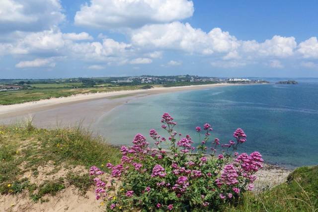
Cwm yr Eglwys Beach (11.5 miles)
The sand and shingle cove of Cwm yr Eglwys is located on the eastern side of the Dinas Island peninsula near Newport. To the back of the beach is a high protective stone wall. This was probably built in response to the enormous 1859 storm which washed away most of the village's 12th century chapel.…
-
Parrog Beach (11.3 miles)
The small town of Newport lies on the Pembrokeshire coastline, not far from the beautiful Preseli hills and at the mouth of the river Nevern. To the north of the river is the wide expanse of Newport Sands, while in front of the town is the small sand and mud beach of Parrog, which doubles…
-
Newport - Car Park Slip Beach (11.4 miles)
Newport is a small town (not to be confused with the city bearing the same name near Cardiff), nestling under the Preseli hills, on the beautiful Pembrokeshire coast. The town offers a choice of places to shop, eat and stay. This beach is at the mouth of the River Nefern (Afon Nyfer) estuary, and the…
-
Newport Sands Beach (11.8 miles)
Newport is a small former fishing town on the beautiful Pembrokeshire coast. Newport Sands, known locally as 'Traeth Mawr' which means "Big Beach" and for good reason - it is around 1.5 miles long. This wide sandy beach, backed by dunes, lies on the other side of the River Nevern estuary from the town. The…
-
-
Pwllgwaelod Beach (11.5 miles)
Pwllgwaelod Beach is a small sandy beach that is encircled by cliffs with views across the water to Fishguard Harbour. The cliffs offer some protection from the wind and at low tide there is a good stretch of sand. The beach is also one of the starting points of a trek that stretches for three…
-
Pwll Gwylog Beach (11.1 miles)
The secluded Pwll Gwylog cove is set at the foot of a deep valley through which a stream snakes. The small curve of shingle beach is flanked by imposing slate cliffs, which provide some shelter from the wind on this north-facing beach. The easiest way to access the beach at Pwll Gwylog is from neighbouring…
-
Neyland Slip Beach (11.1 miles)
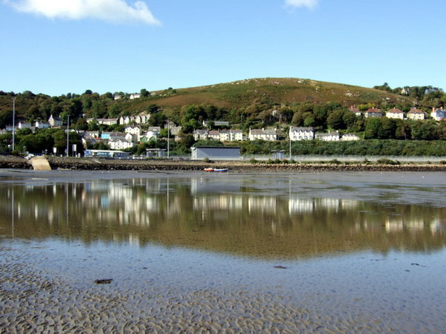
Neyland Slip is a small area of mud and shingle beach located next to the slipway. Part of the parish of Llanstadwell, Neyland was once a working harbour and busy fishing village. With easy access to the sheltered waters of Milford Haven water sports are popular here. Sailing is a particular favourite here and you…
-
Goodwick Sands Beach (11.1 miles)
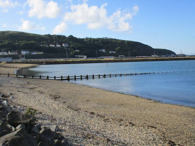
This beach, with its mix of sand and shingle, lies close to the Fishguard-Rosslare Ferry Terminal which is linked by train to London. The beach is divided by a series of wooden groynes and has a sea wall composed of quarried boulders. There is a narrow promenade and a breakwater along which it is possible…
-
Goodwick - Harbour South Beach (11.3 miles)
Goodwick Harbour is a sandy beach within the walls of Fishguard Harbour from where a ferry service operates to Rosslare in Ireland. It is separated by the harbour wall from Goodwick Sands. Whilst the beach is popular for walking, swimming, water sports, and watching the ferries entering and leaving the harbour at low tide, at…
-
Saundersfoot Beach (12.6 miles)
Situated in front of the village of Saundersfoot with its small harbour this sandy beach is very popular. The gently sloping sands make for safe swimming and all amenities are provided by the shops and cafes along the beachfront. All in all this a great family beach.
A short walk to the north, along the…
Coppet Hall Beach (12.5 miles)
Even when the tide is out, this small but sandy beach has plenty of space, although do check tide times to make sure you don’t get cut off. At low tide, there’s ample room for beach games, and great spots for crabbing. You can access the sand from the central steps in front of the…
Wisemans Bridge Beach (12.3 miles)
Wisemans Bridge Beach lies between Saundersfoot and Amroth and is linked to the rest of the coastline via a series of paths and tunnels. As such, ramblers flock here for the scenic views and the sheer number of trails in the area.
You can easily walk here from Saundersfoot and it is a good choice…
Glen Beach (13 miles)
This small, sandy beach lies just south of Saundersfoot Harbour and Beach, on the Pembrokeshire coastline. The beach is backed by low cliffs and dense woodland, and the Pembrokeshire Coastal Path passes through the trees just behind the beach. From the beach there are views out over Saundersfoot Bay and down the coast to Monkstone…
Gelliswick. Milford Haven Beach (13.2 miles)
Gelliswick is a sheltered sand and shingle and sits in a bay close to Milford Haven. The beach got its name from the Vikings who invaded this part of the coast of Pembrokeshire which is why there is a ‘vik’ suffix applied to the name which means harbour. It used to be popular for swimming…
Waterwynch Bay (14.1 miles)
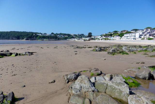
At low tide Waterwynch Bay Beach is a long sandy beach formed from two coves. It is backed by a pebble bank which is all that remains at high tide as the golden sands disappear completely. The beach is often eschewed in favour of the more popular resort town of Tenby, although this is a…
Porthsychan Beach (14 miles)
Set in a sheltered cove near the north-westerly tip of Pembrokeshire is the pleasant little beach of Porthsychan. What the beach lacks in sand (it is mostly shingle and pebble) it makes up for in charm. Here you will find an abundance of rock pools and the waters within the little bay are generally quite…
Monkstone Beach (13.9 miles)
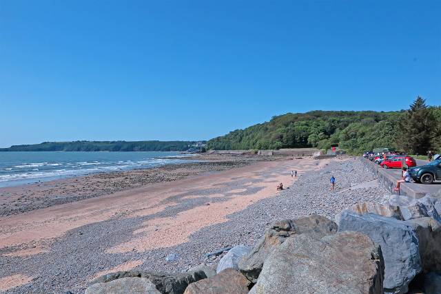
A couple of miles north of Tenby is Monkstone beach, a fine stretch of golden sand punctuated by the occasional rock. This is a fairly sheltered beach and swimming here is generally safe, although there are no lifeguards. You'll also find plenty of rockpools. It is a bit of a walk from the nearest parking…
North Tenby Beach (14.7 miles)
Tenby North Beach is easy to spot if you are in Tenby thanks to the iconic Goscar Rock the rears out of the sand in the centre of the strip. The beach is one of the best-loved in the area and is tucked away between Harbour Beach and the elegant North Cliffs. As a result,…
South Tenby Beach (15.1 miles)
Tenby South Beach stretches for a mile and a half across coast that backed by soft sand dunes. The beach is located between St Catherine’s Island and the headland of Giltar Point. The area closest to Tenby town is the most popular part of the beach but if you walk a little further along towards…
Castle Beach (15 miles)
Nestled between the historic town of Tenby, Tenby Castle, and the St Catherine’s Island are the fine sands of Castle Beach. The beach here stretches southwards, joining up with the expanse of sand that is South Tenby Beach.
At low tide, St Catherine’s Island is connected to the beach and can be reached on foot.…
Freshwater West Beach (16.2 miles)
Freshwater West Beach is a long strip of sandy beach which is backed by the extensive dune system of Broomhill Burrows. It is an area with a fascinating history as it was once used by smugglers as a place to stash their booty.
Located on Wales' exposed west coast the beach at Freshwater West picks up…
St Davids beaches map
Map featuring St Davids beaches. Click on pins to view beach details