Humberston Fitties Beach Photo
Humberston Fitties 3 (aerial), 2007
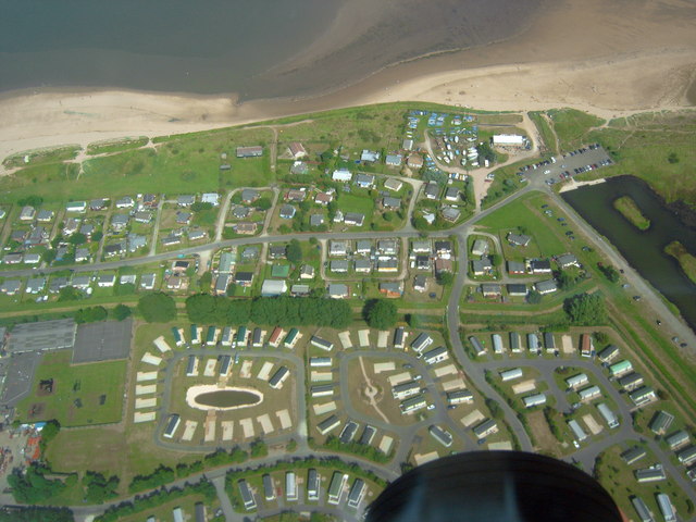
The SE section including the yacht club. 'Fitties' is a local word meaning 'salt marsh'. The Humberston Fitties were originally one of a number of fitties along this part of the coastline. The Humberston Fitties developed when the area was divided up into plots of different sizes during the 1920's. These areas became known as plot lands. During the First World War the coastal area was used for billeting soldiers who were stationed in the nearby Haile Sands Fort. After the war a local family set up a tent so they could have access to fresh air to combat ill health. The following year they erected a chalet and after the soldiers were demobbed other people moved in with tents or into the original camp huts used by the soldiers. More holidaymakers arrived bringing their own accommodation in the form of caravans, buses and old railway carriages. As the area developed holiday chalets were built on stilts and wheels because the area was prone to flooding. In 1938 the land ownership was passed to the local authority. This has allowed us to preserve this unique area when other similar private plot lands have been gradually sold off for development over the years. During World War II the chalets were again returned to military duty, and it is believed that a decoy representing Grimsby Docks was erected nearby. http://www.nelincs.gov.uk/resident/arts--events-and-tourism/humberston-fitties/history-humberston-fitties/; http://www.humberstonchalet.co.uk/old/htm/history.asp
© John Hardy and licensed for reuse under this Creative Commons Licence
Taken at: Humberston Fitties Beach, North East England
Date taken / added: 8th Aug 2007


