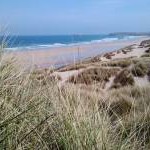
Duporth Beach Photo
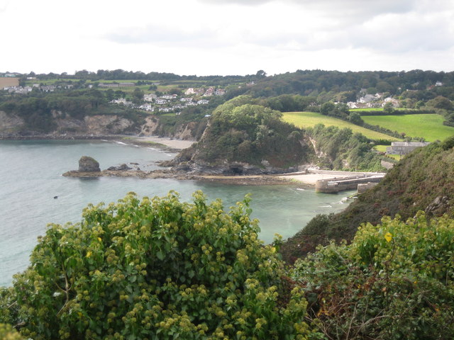
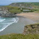
Headland between Charlestown Harbour and Du Porth beach
The southern breakwater of Charlestown harbour can be seen to the right of the image. An un-named headland (on 1:25k and 1:50k maps) in the centre of the image separates the approach to Charlestown harbour with Du Porth beach beyond. The rocks offshore from the headland are called Polmear Island. The settlement of Duporth can be seen on the cliff above Du Porth beach. The masses of Ivy growing on the cliffs in the foreground provide late food for invertebrates such as bees and flies. When I walked this section of the South West Coast Path in September 2007 the length between Charlestown and Carrickowel Point (at the southern end of Du Porth beach) had recently been closed due to a landslip, so forcing a lengthy diversion by road. This stretch has recently been reopened (Jan 2012).
© Caroline Tandy and licensed for reuse under this Creative Commons Licence
Taken at: Duporth Beach, South West England
Date taken / added: 16th Sep 2007